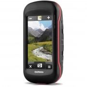
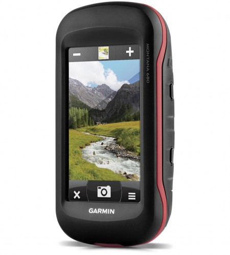
Garmin Montana 680
Rugged GPS/GLONASS with 8 Megapixel Camera and BirdsEye Subscription
- 4-inch dual-orientation, glove-friendly touchscreen display.
- 8 megapixel autofocus camera; automatically geotags photos.
- Tracks both GPS and GLONASS satellites.
- 1-year BirdsEye Satellite Imagery subscription.
- 3-axis compass with barometric altimeter.
Plan Your Next Trip
Our free BaseCamp software lets you view and organize maps, waypoints, routes and tracks. This free trip-planning software even allows you to create Garmin Adventures that you can share with friends, family or fellow explorers. BaseCamp displays topographic map data in 2-D or 3-D on your computer screen, including contour lines and elevation profiles.
Physical & Performance
|
| Physical dimensions |
2.9″ x 5.7″ x 1.4″ (7.48 x 14.42 x 3.64 cm) |
| Display size, WxH |
2″W x 3.5″H (5.06 x 8.93 cm); 4″ diag (10.2 cm) |
| Display resolution, WxH |
272 x 480 pixels |
| Display type |
bright, transflective 65k color TFT, dual-orientation touchscreen; sunlight readable |
| Touchscreen |
|
| Weight |
10.2 oz (289 g) with included lithium-ion battery pack; 11.7 oz (333 g) with 3 AA batteries (not included) |
| Battery |
rechargeable lithium-ion (included) or 3 AA batteries (not included); NiMH or Lithium recommended |
| Battery life |
up to 16 hours (lithium-ion); up to 22 hours (AA batteries) |
| Water rating |
IPX7 |
| High-sensitivity receiver |
|
| Interface |
high-speed USB and NMEA 0183 compatible |
| Camera |
yes (8 megapixel with autofocus; automatic geo-tagging) |
| Barometric altimeter |
|
| Electronic compass |
Yes (tilt-compensated 3-axis) |
| Unit-to-unit transfer (shares data wirelessly with similar units) |
|
Maps & Memory
|
| Basemap |
|
| Ability to add maps |
|
| Built-in memory |
4 GB |
| Accepts data cards |
microSD™ card (not included) |
| Custom POIs (ability to add additional points of interest) |
|
| Waypoints/favorites/locations |
4000 |
| Routes |
200 |
| Track log |
10,000 points, 200 saved tracks |
Outdoor Features
|
| Automatic routing (turn by turn routing on roads) |
Yes (with optional mapping for detailed roads) |
| Geocaching-friendly |
Yes (Paperless) |
| Custom maps compatible |
|
| Hunt/fish calendar |
|
| Sun and moon information |
|
| Tide tables |
Yes (with optional Bluechart) |
| Area calculation |
|
| Picture viewer |
|
Garmin Connect™
|
| Garmin Connect™ compatible (online community where you analyze, categorize and share data) |
|
Kelengkapan :
- Montana 680
- Lithium-ion battery pack
- USB cable
- AC charger
- Quickstart Guide